The Umayyad Caliphate was a powerful Islamic dynasty that ruled from 661 to 750 CE, with its capital in Damascus. Under their rule, the Islamic empire expanded rapidly, reaching Spain in the west and India in the east.
The Umayyads promoted Arab culture and language and built magnificent architectural achievements, such as the Dome of the Rock in Jerusalem and the Great Mosque of Damascus. However, their rule was also marked by controversy and opposition, especially from those who believed the caliphate should be held by a member of the Prophet’s family. The Umayyads were eventually overthrown by the Abbasid dynasty in 750 CE.
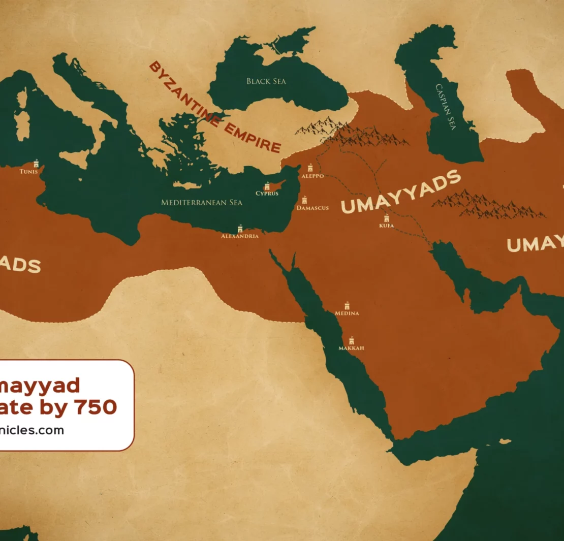
Umayyad Caliphate by 750 CE. The map shows the territory either ruled or controlled by the Umayyad Caliphate (between 661 to 750 CE).
Download here in 4K resolution

Last updated on August 29th, 2024 at 05:34 pm
Support us
Support Islamic Chronicles on Patreon and help us continue creating ad-free, high-quality content on the rich and diverse history of Islam and Muslims. Your support keeps our platform independent, educational, and accessible to all.
Become A Patron Now